data science Prototypes


Berliner Erfrischungskarte/Berlin Refreshment Map (2022) for the Open Data Informationsstelle Berlin [developed using R, RGrass and Mapbox]
This web map of the city of Berlin visualises temperature conditions, cold air conditions and shaded areas. This data can be displayed for every hour of the day between 10 am and 8 pm. The map thus provides information on which places have comparatively higher or lower temperatures and at which times of the day shade and sun can be expected where. It also shows various places, such as public swimming pools, green spaces and water playgrounds, where citizens in Berlin can refresh themselves on hot days. Using the share function, users can save and share their favorite place. The application is based on a simulation of solar radiation using a digital terrain model and the interpolation of climatic model data from the Berlin Senate Department for Urban Development.
Blogpost available here (in English) and here (in German).
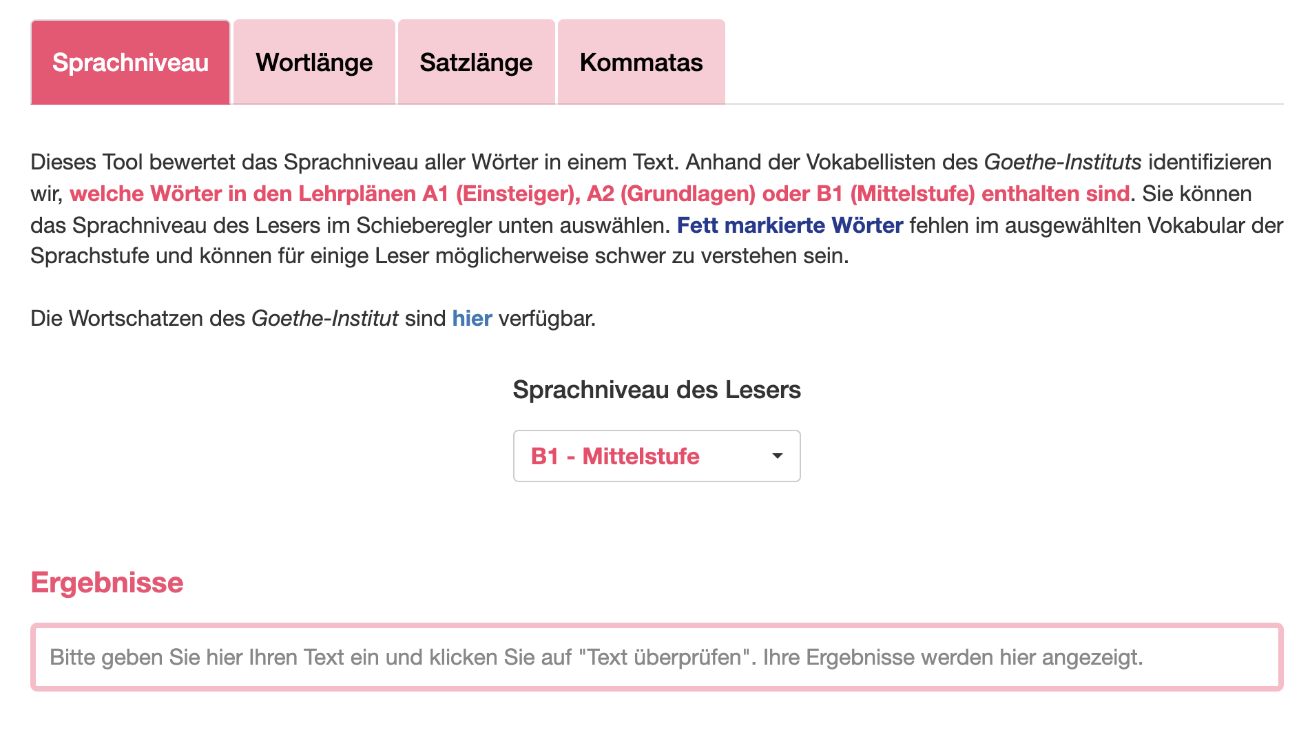
Sprach-o-Mat/Text Complexity Analyzer (2022) for the Open Data Informationsstelle Berlin [developed in Shiny]
This tool performs a diagnosis of the level of complexity of German texts. It provides 4 different diagnostics. (1) Sprachniveau (language level): allows the user to identity the words that are not encompassed in language levels A1, A2 or B1 (default: B1). (2) Wortlänge (word length): allows the user to identify words containing more letters than a self-defined limit (default: 10 letters). (3) Satzlänge (sentence length): allows the user to identify sentences containing more words than a self-defined limit (default: 30 words). (4) Kommatas (commas): allows the user to identify sentences containing more commas than a self-defined limit (default: 3 commas).
Wahlbezrik Editor/Electoral District Optimizer (2021) for the Open Data Informationsstelle Berlin and the City Lab Berlin [developed using R and JavaScript]
The objective of this project is the development of a software that helps city employees adjust the boundaries of electoral or voting districts (Wahlbezirke) between election years. Our final product is a user-friendly tool that automatically generates and evaluates optimized districting maps for Berlin’s boroughs (Bezirke). The intuitive interface allows users to make their own modifications to algorithmically generated electoral maps. Our algorithm uses official governmental data in order to generate iterations that maximize both the geographical compactness of districts and the evenness of the population distribution across the borough.